
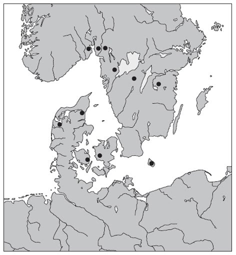
 The importance of Gudme and the Gudme complex in Funen for our understanding of the interrelationship between religion and political power and its manifestation in the landscape in Late Iron Age society, is huge (Nielsen et al. 1994; Sørensen 1994). Archaeologically speaking the area is a prime example of a wealth centre or central place from the Late Roman and Migration periods in Scandinavia. The place-names in the area point to Gudme as a site of religious significance too; not least the name Gudme itself, which literally means ’home of the gods’ (Kousgård Sørensen 1985; Beck 1995; Vikstrand 2004). The appellative place name guðheimr occur elsewhere in Scandinavia as well. Eleven instances are known, including Gudme on Funen, and three of these are found in Norway. In all three instances guðheimr denote farms in the Oslofjord area; two in Østfold and one in Vestfold. These farms have from time to time been part of the scholarly discussion about Gudme on Funen and its significance (for instance Hauck 1988), but they have rarely been considered in their own right and in their local archaeological context. Were the farms in the Oslofjord area really ’homes of the gods’? Are they ’special’ in an archaeological sense? The purpose of this paper is to show some light on this question.
Gudum in Holmestrand, Vestfold
As early as 1880 a remarkable toponymic complex near the Oslofjord in Botne parish in the northern part of Vestfold was noted by the O. Rygh (Rygh 1880:211). Here, within a distance of 2 km, are three farms named Gudum (guðheimr), Gurann (guðrann, -rann, large house, see Vikstrand 2004:169) and Guåker (guðakr, -akr, field). This complex was later discussed by M. Olsen (1915:99, 209, 223, cf 1928:279), who reached the following conclusion:
 ’Here, both local and linguistic considerations point toward not only a cultic site, but a cultic district, with the three farm names probably being contemporary. From the three names in Botne we thus learn that near the mountainous northern part of the Botne plateau there once were both a heathen ’god’s house’ (Goðrann) and a field belonging to heathen gods. It is obvious that a cultic district like this should have served a greater area, and not only a small number of farms. The easiest access to this district would have been from the beach down below, and it is only natural that we find the place name Guðeim(a)r somewhat to the east from *Guðakr and Goðrann, and close to where the Botne plataeu slopes down toward the fjord. Most likely the whole area from the two latter places and all the way to the coast was once called Guðeim(a)r’ (1915:99, my transl.).
Olsen went further, and painted a vivid picture of the rituals that he suggested took place in this area:
’The hieros gamos of the pair of gods - in either an original or a more watered down form – happened at *Guðakr; the procession with the god’s image moved across Guðeimr back to the ’god’s house’, Guðrann, where the idol was kept, and where the congregation, provided the god’s house was as big as the public hofs of a later period, might have held a feast. Here is also a small lake, where the idol might have been washed’ (1915:209, my transl.).
More recent research has focused on the name Gudum, which according to J. Kousgård Sørensen signifies a ’Ort, wo die Götter sich aufhalten, wo sie zu Hause sind und wo sie zum Gegenstand eines besonderen Kultes gemacht werden’ (1985:136). Following his suggestion, K. Hauck (1988) attributes to the guðheimr name in Botne great explanatory power when he discusses gold bracteate distribution and long-distance contacts in the Migration period. According to Hauck, the Gudme sites were cult places along a sea route, and seafarers could sacrifice to the gods for a happy journey there. He sees the bracteates as amulets expressing the benevolence of the gods. Paying special attention to A-bracteates with god and boar as motif, he connects these bracteates with a sea route leading from Gudum in Vestfold down the Swedish West coast to Gudme on Funen (1988:205ff). There are two finds of A-bracteates from Vestfold relevant to Hauck’s discussion, both of which he connects with Gudum, namely Mackeprang no 133 from Bjørnerud in Sande and no 134 from Haugan in Sandeherred.
However, Hauck’s interpretation of the importance of Gudum – while interesting and thought-provoking – rests almost solely on the place name itself and the hypothetical connection between Gudum and the bracteate finds. The latter is not really argued for, just proposed. In fact, while Bjørnerud is located c. 15 km to the north of Gudum, Haugane lies almost 40 km to the south of it, and considerably closer to other possible religious and political centres in the south of Vestfold than Gudum (see for instance Skre 2007). This suggests that Gudum in Botne needs to be put into its local and archaeological context.
The northern part of Vestfold is rarely integrated into archaeological discourses (but see Skjelsvik 1960; Skre & Stylegar 2004). Botne belongs to a part of the region that is little known, archaeologically speaking. While Vestfold has seen large scale excavations during recent years, these have mainly taken place further south in Vestfold, from Tønsberg and further to the South and West (Gjerpe ed 2005, 2008a-c). The extensive cemeteries from the Roman and Migration periods in Vestfold are all located on the Ra moraine between Horten and Larvik, as well as in areas further south. The number of Iron Age finds from the northern part of Vestfold is relatively low, and only a few settlements are known. There are several smaller cemeteries in the area, however, and from time to time they yield very interesting finds (see for instance Resi & Sjurseike 2004), which seems to indicate that a relatively low level of archaeological activity is partly responsible for the situation.
Botne is no different in this respect. Today a part of Holmestrand local authority, Botne is situated on a plateau overlooking the small town of Holmestrand and the Oslofjord some 100 m below. On the Botne plateau are found extensive clay plains suitable for agriculture. Gudum is located in the middle of the plateau, a few hundred meters to the north of Botne parish church, with Gurann and Guåker further to the west. Gudum and Gurann are known from written sources dating to the Late Medieval period. The farms themselves are nothing out of the ordinary when it comes to size; Gurann is actually a rather small farm. Except for a number of solitary and lesser groups of grave mounds, the area seems to offer little to archaeologists with a liking for the Roman and Migration periods; significantly, Botne parish as a whole does not take up more than a couple of pages in Vestfolds oldtidsminner (Grieg 1943:143ff, cf Skjelsvik 1960).
Still, there seems to be some potential in the area when put into a somewhat bigger context, if not quite as big as Hauck did. I would like to draw attention to a couple of special finds of golden objects from the Late Roman and Migration periods not far away from Gudum, but in the neighbouring parish. Most importantly, the golden neck ring from Ofegstad in Våle, a farm situated only 5-6 km to the south of Gudum. This remarkable object, which has its closest parallell in the ring from Strårup in Jutland, weighs close to 250 g and stands out in the contemporary artefact assemblage from Vestfold. There is also the C-bracteate from Jonsrud in Våle, at about the same distance from Gudum. I consider the find spot of the Bjørnerud bracteate, however, as situated too far away from Botne to discuss it in the present context.
Furthermore, the toponymic environment has more on offer than Gudum and its two pendants (cf Skre & Stylegar 2004:71ff). About 4 km away from Gudum, in the Greåker valley stretching south from Gurann, is the farm Vidskjøl (a Uidaskiage in 1378, possibly *Viðarskjálfr, cf Olsen 1967 [1922]:316; 1928:318ff) as well as a farm called Kaupang (see Sørensen 1975). Further south is a farm named Huseby (Steinnes 1955, cf Westerdahl & Stylegar 2004:101). Closer to the Oslofjord, and near the southern end of the Botne plateau, are two farms called Helgeland (Hælgaland in 1390, possibly from heilagr, sacred; NG VI:84) and Hundsal (i Hundzale in 1390, possibly from –salr; NG VI:85) respectively. Even closer to the fjord, and c. 8 km to the south of Gudum, is Freberg (Frøyberg in 1390, either from the god’s name Frøyr or the goddess’ name Frøyja, and -berg, hill or mountain; NG VI:122). The slope from the plateau down to Holmestrand with the town’s good natural harbour is rather steep; it is highly interesting that there is another more easily accessed natural harbour 6 km to the south from Gudum, namely Snekkestad. It is one of only two snekkja-names in Vestfold (Stylegar & Grimm 2003), the other one being close to Borre.
This whole complex occupies an area of less than 100 square kilometers, either on the Botne plateau or bordering on it. Some of these place names seem to be of types that in a number of cases are associated with Late Iron Age central places or central place complexes (Brink 1996, 1997, 2007; Hellberg 1986; Vikstrand 2004).
But the relative peripheral situation and modest size of some of these farms have led a few scholars to conclude that what we have here, are cases of farms being named after more well-known sites. This is what A. Steinnes suggested for Huseby in Botne (Steinnes 1955), and this was also A.W. Brøgger’s conclusion after he visited Botne’s Kaupang in 1928, writing that ’it seems quite unthinkable thas this unimportant and peripheral place was ever a market place’ (quoted after Sørensen 1975:43). There is at least one certain case of naming of this kind in our area, namely the farm Serkland, and one could argue along similar lines for the two neighbouring farms Island and Grelland (i Gronlandæ in 1390).
I do not want to overstate the similarities that seem to exist between the Botne area and more thoroughly studied central place complexes in South Scandinavia. Some of the other aspects generally found when dealing with central places do however seem relevant to our case, especially the strategic location of these sites communicationwise (cf Fabech 2001; Näsman 2000). Here I have the situation of Gudum in mind in particular, since the farm occupies a very central position at the main road between the inner Oslofjord area and southern Vestfold. Just to the north of Gudum is the notorious Angerskleiva (Angars kleif in 1390), winding down to sea level in Sande (see for example Nilssøn 1991:64, 84, 96; for the archeological aspects: Gansum 2002:24). For centuries there were only two passages on land between Oslo and Tønsberg, and both of them run across the Botne plateau. The steep sea coast in this part of the Oslofjord meant that traffic could not follow the shore. Instead, it was forced up on the plateau, at Angerskleiva near the coast and at Hanekleiva a bit further inland. This traffic pattern alone casts some doubt on the supposed peripheral status of Botne.
Other aspects usually associated with central places are however conspiciously absent in the area; not least big burial mounds or other monuments. If Gudum was ever a central place, it might thus have been a central place of a different kind from Gudme on Funen and other well-studied sites in South Scandinavia. Perhaps this was, as Magnus Olsen believed, first and foremost a ritual site, a place apart and reserved for the gods?
In conclusion, while Hauck’s (and in some respects M. Olsens) case for Gudum’s central role seems overstated in light of the available sources, both the gold finds, in particular the Ofegstad ring, the place-names and for that matter the ancient system of communications in the region point to the Botne plateau as a very promising area for archaeology. But until more excavations are carried out in this part of Vestfold, we must regard the status of Gudum and the surrounding area in the Late Roman and Migration periods as uncertain.
Gudim in Rakkestad, Østfold
The two remaining guðheimr farms in the Oslofjord area are both located in Østfold – Gudum in Skiptvet and Gudim in Rakkestad. As in Vestfold, a number of large excavations have taken place in Østfold during recent years, but mostly focused on the Ra moraine, which here runs south-north from Halden to Moss (Baardseth ed 2007a-c, 2008). Furthermore, as in Vestfold, most big cemeteries from the Iron Age are found in the Ra area, as well as on marine deposits closer to the Oslofjord (see, for instance, Petersen 1916; Resi 1986; Wangen 2009). Various authors have argued that the area centred on Tune near Sarpsborg was particularly important during the Iron Age (for instance Pedersen et al. 2003:299-333).
 But it would not be advisable to push the similarities with Vestfold much further than this, because seemingly unlike its neighbouring county across the fjord, Østfold has an interior region with a lot of archaeology on offer (one could argue the same for Vestfold, but mainly limited to the Lågen river valley). Centered on the Monaryggen moraine in Askim and Eidsberg is an area of considerable importance for agriculture, and in this area we find a number of large cemeteries. Several scholars who have published occasional finds from this area, have pointed out that this part of Østfold is undervalued, archaeologically speaking, for instance J. Martens, who recently published the weapon grave find from Bøli in Eidsberg, ”by far the richest burial from the Pre-Roman Iron Age in Norway” (Martens 2008:318-319). If we look at Migration period finds from Østfold, it is remarkable that the majority of bracteates and other special gold finds are found in the interior, with the Sletner hoard as the foremost example, together with the Tøyen hoard, which, although it was found just north of the border between Østfold and Akershus, clearly belongs to this group.
Rakkestad constitutes a southern extension of this area. It is separated from the Ra district further south by forests, while forested, uphill areas also set limits for agriculture and habitation to the east. The central parts of Rakkestad are located between the Rakkestad river and the Dørja river, both subsidiaries to the Glomma river. Here is the parish church, and c. 2 km to the north of it is Gudim (i Gudæimi in 1390, NG I:94; Rygh 1880:204), situated on a headland near both rivers. The farm lies near the modern day population centre of Rakkestad, and much of the farm land has been developed during recent years. Until the agricultural improvement in the 19th century Gudim and its neighbouring farms were separated from the farms further to the east by extensive wetlands. While Gudim by local standards was a big farm, its size was surpassed by a number of other farms in the area. The farm was probably hit rather badly by the late-medieval agricultural crisis, when one of the two Gudim farms mentioned in medieval sources was abandoned (Lunde 1990:38).
There are several cemeteries and lesser grave groups in the central part of Rakkestad; some of which have yielded rich finds, including Late Roman imports from Østby and Ski (Johansen 1989:178ff). As for Gudim itself, a big mound near the farm houses were destroyed in the 1860s, and a timbered chamber was found innside (Lorange 1869:69). However, since no artefact finds were reported, we do not know the date of this burial, even if the description is reminiscent of the wooden chamber in the Late Roman period chamber grave at Sætrang in Ringerike. A cemetery located elsewhere at Gudim counted 9 mounds, none of which are left today (Johansen 1989:182). Another notable find from Gudim is of Viking Age date: a cruciform Insular mount of copper alloy (Blindheim 1960). The largest cemetery in Rakkestad is at the Gjulem farm, c. 1 km nortwest of Gudim, and it seems likely that Gjulem was the central farm in the area in the Iron Age (Johansen 1989:178, 229).
But none of the Migration period gold finds from the interior region of Østfold seems to be associated with Gudim – or with Rakkestad. The nearest find spot is Lille-Skjør, c. 8 km to the north. It would seem that the bracteates’ primary area of distribution is centred on the moraine area to the north of Rakkestad. As for the toponymic environment, Gudim seems more isolated than its counterpart in Vestfold. The neighbouring farm on the other side of the former wetland area near Gudim is called Lund, and there is a Snekkenes where the Rakkestadelva meets the Glomma; this is one of only a very small number of snekkja names in Østfold. An abandoned farm – exactly where it was located, we do not know – is intriguingly named ’Gudeshoff’ in sources dating to the 17th century (Lunde 1990:180). Apart from this, place-names of the same general types as we saw were associated with Gudum in Botne are absent, although they have a pronounced presence just a few kilometers further north.
Rakkestad was traditionally a junction where several routes between the Ra areas and the interior meet (Pedersen et al. 2003:280ff). The interior region of Østfold as a whole was also important for communication between the Lower Romerike area and the coast. At least in the High Middle Ages, however, some of the traffic was by ships on the Glomma river, passing by Rakkestad, but with a major portage across Eidsberg and Askim.
To conclude, both the Gudim farm and its local environs has a lot going for it archaeologically, much more so than Gudum in Vestfold seemingly has. On the other hand, it looks as if the Rakkestad area is best understood as a subsidiary of the more extensive farming area centred on the Monaryggen moraine further north. Like Gudum and the Botne plateau, Gudim in Rakkestad could be another case of relative marginality within a central area.
Gudum in Skiptvet, Østfold
Our third case is Gudum (i Gudæimi in 1390, NG I:82; Hoel 1997:59) in Skiptvet, the local authority situated just across the Glomma river from Rakkestad. Most marine deposits in Skiptvet are found near the Glomma, and here are the main agricultural areas in the district. Skiptvet has considerably less arable land than Rakkestad, and the western parts of the district consist in the main of uphill, forested land. This forested part of Skiptvet was formerly called Mørkja (from morkin, wood, see Hoel 1997:143). It is here, c. 5 km from the Glomma in what seems to be a marginal area in Skiptvet, that Gudum is situated.
In general, we have very limited knowledge about the archaeology of Skiptvet. The monuments are few, and there are very few Iron Age finds from the area. The smaller settlement-district where Gudum is situated, the Lundsgrenda, is completely anonymous, archaeologically speaking; no registered monuments and no finds.
Gudum is not a particularly big farm. In the late-medieval period the farm was given up on as an independent entity and it became a part of the bigger neighbouring farm, Lund (firir Lund in 1390, Hoel 1997:59). Still today, Gudum is a part of Lund. The toponymic environment is rather similar to Gudim in Rakkestad: Besides Gudum and Lund, there is a neighbouring farm called Haug (Houg, Houff in 1560-1561, Hoel 1997:58). Near Gudim in Rakkestad there is a farm called Haug(-gård) (Haughagard in 1456, NG I:107), as well, and a neighbouring farm of Gudum in Botne is also called Haug (i Haugi in 1390, NG VI:72).
While Gudim in Rakkestad and Gudum and Botne are situated near important roads, this is not the case with Gudum in Skiptvet. With the lake near Gurann in Botne in mind, one might note that there is a small lake near Gudum as well, called Lundstjern.
Conclusion
The three guðheimr farms in the Oslofjord area are very different places, and they do not really compare well. Gudum in Skiptvet is situated in a marginal part of a relatively marginal district. Archaeology cannot really throw any light on this particular farm. Similarly, Gudum in Botne is situated in a part of Vestfold where few archaeological finds and monuments from the Late Roman and Migration periods are known. However, unlike the farm in Skiptvet, the latter farm lies near an important land route between the inner Oslofjord area and Tønsberg and the southern part of Vestfold, and one or two important Migration period gold finds are known from the area. Furthermore, in the vicinity of the Gudum farm we have several other ’special’ place-names. The third guðheimr farm, Gudim in Rakkestad, is a different story. It it situated in a part of Rakkestad that in different ways, and also archaeologically, belongs to a central area in the interior region of Østfold. In several respects this area is comparable to the Ra area near the coast. Gudim might thus seem to be a settlement of a different order than its counterparts in Botne and Skiptvet.
Based on the available evidence, there is little to suggest that a new Gudme awaits us on any of the three sites in the Oslofjord region. But only systematic survey work, utilising metal detectors and other technologies, can help us decide the type and character of the three sites. So far, too little has been done. Judging by the available evidence, Gudim in Rakkestad could be a very interesting area for archaeologists. Gudum in Vestfold and the Botne plateau might also hide some surprises, while we are archaeologically still in the dark when it comes to the status of Gudum in Skiptvet.
It is worth mentioning briefly three other sites in southeastern Norway where archaeology and place-names really do seem to reinforce each other and point towards central place complexes. Two of these have been mentioned in passing earlier, namely the area around Larvik in Vestfold, the Skiringssal district, that is (Skre & Stylegar 2004; Brink 2007; Skre 2007), and the Ra area near Sarpsborg in Østfold, probably centred on Tune (Steinnes 1951; Stylegar 1998; Pedersen et al. 2003:299-333). Both these areas have important finds from the Roman period up to and including the Viking Age, as well as groups of place-names of types that seems to be associated with Iron Age central place complexes (Brink 1996, 1997, 2007; Hellberg 1986; Vikstrand 2004). The third important area in this respect is of course the settlement districts near Hamar on the Lake Mjøsa, famous for the early 7th century Åker find, but with a number of high-class finds from both the Roman Period and the Viking Age as well (Mikkelsen & Larsen ed 1992; Rolfsen 2000), and many place-names of the aforementioned types (see Olsen 1915:98ff). In all three cases, both the place-names and relevant monuments and finds are distributed across relatively wide areas, not unlike what we encountered in Rakkestad, and to some extent in Botne as well. And while there are no guðheimr names either in Larvik, Sarpsborg or Hamar, there are other names with the element guð (Guð-akr, Guð-vin).
References
Baardseth, G.A. (ed) 2007a. Hus og gard langs E6 i Råde kommune. E6-prosjektet Østfold 1. Kulturhistorisk museum, Fornminneseksjonen varia 65. Oslo.
Baardseth, G.A. (ed) 2007b. Hus, gard og graver langs E6 i Sarpsborg kommune. E6-prosjektet Østfold 2. Kulturhistorisk museum, Fornminneseksjonen varia 66. Oslo.
Baardseth, G.A. (ed) 2007c. Hus og gard langs E6 i Fredrikstad og Sarpsborg kommunar. E6-prosjektet Østfold 3. Kulturhistorisk museum, Fornminneseksjonen varia 67. Oslo.
Baardseth, G.A. (ed) 2008. Evaluering – resultat. E6-prosjektet Østfold 5. Kulturhistorisk museum, Fornminneseksjonen varia 69. Oslo.
Beck, H. 1995. Namenkundlich-religionsgeschichtliche Bemerkungen zur Gudme-Diskussion. F. Marold & C. Zimmermann (eds): Nordwestgermanisch, pp 41-55. Berlin.
Blindheim, C. 1960. Fra Østfolds vikingetid. Et keltisk bronsearbeid fra Rakkestad. Østfoldarv 5, pp 7-14. Sarpsborg.
Brink, S. 1996. Political and Social Structures in Early Scandinavia. A Settlement-historical Pre-Study of the Central Place. TOR 28, pp 235-281. Uppsala.
Brink, S. 1996. Political and Social Structures in Early Scandinavia 2. Aspects of Space and Territoriality – the Settlement District. TOR 29, pp 389-437. Uppsala.
Brink, S. 2007. Skiringssal, Kaupang, Tjølling – the Toponymic Evidence. D. Skre (ed): Kaupang in Skiringssal, pp 53–64. Kaupang Excavation Project Publication Series, Volume 1. Norske Oldfunn XXII. Oslo – Århus.
Brøgger, A.W. (ed) 1932. Østfolds oldtidsminner. Arkeologiske landskapsundersøkelser i Norge 1. Oslo.
Gansum, T. 2002. Hulveger – fragmenter av fortidens ferdsel. Tønsberg.
Gaustad, F. 1960. Et jernalders gravfelt i Rakkestad, Østfold. Universitetets oldsaksamlings årbok 1958-1959, pp 50-77. Oslo.
Gjerpe, L.E. (ed) 2005. Gravfeltet på Gulli. E18-prosjektet Vestfold 1. Kulturhistorisk museum, Fornminneseksjonen varia 60. Oslo.
Gjerpe, L.E. (ed) 2008a. Steinalderboplasser, boplasspor, graver og dyrkningsspor. E18-prosjektet Vestfold 2. Kulturhistorisk museum, Fornminneseksjonen varia 72. Oslo.
Gjerpe, L.E. (ed) 2008b. Hus, boplass- og dyrkningsspor. E18-prosjektet Vestfold 3. Kulturhistorisk museum, Fornminneseksjonen varia 73. Oslo.
Gjerpe, L.E. (ed) 2008c. Kulturhistoriske, metodiske og administrative erfaringer. E18-prosjektet Vestfold 4. Kulturhistorisk museum, Fornminneseksjonen varia 74. Oslo.
Grieg, S. (ed) 1943. Vestfolds oldtidsminner. Arkeologiske landskapsundersøkelser i Norge 2. Oslo.
Hauck, K. 1988. Völkerwanderungszeitlicher Seeverkehr, erhellt mit Schiffsresten und Fundorten von Goldbrakteaten. Zur Ikonologie der Goldbrakteaten XXXIX, Trade and exchange in prehistory – studies in honor of Berta Stjerquist. Acta archaeologica Lundensia 16. Lund.
Hellberg, L. 1986. Hedendomens spår i uppländska ortnamn. Ortnamnssällskapets i Uppsala årsskrift, pp 40–71.
Hoel, K. 1997. Bustadnavn i Østfold 2. Skiptvet. Oslo.
Johansen, Ø.K. 1989. Forhistorien. Rakkestad bygdebok 1. Rakkestad.
Kousgård Sørensen, J. 1985. Gudhem. Frühmittelalterliche Studien 19, pp 131-138.
Lorange, A. 1869. Student A. Loranges udsigt over hans antikvariske virksomhed i 1868. Foreningen til Norske Fortidsmindesmerkers Bevaring Aarsberetning for 1868, pp 38-84. Kristiania.
Lunde, A. 1990. Bygdehistorien fra 1000 til 1800. Rakkestad bygdebok 2. Rakkestad.
Mackeprang, M. 1952. De nordiske guldbrakteater. Jysk Arkæologisk Selskabs skrifter 2. Aarhus.
Martens, J. 2008. A princely burial at Bøli vestre, Østfold. The (re-)introduction of weapon burial rites in Iron Age Norway. K. Chilidis, J. Lund & C. Prescott (eds): Facets of archeology. Essays in honour of Lotte Hedeager on her 60th birthday, pp 309-322. Oslo archaeological series 10. Oslo.
Mikkelsen, E. & J.H. Larsen 1992. Økonomiske og politiske sentra i Norden ca 400-1000 e.Kr. Åkerseminaret, Hamar 1990. Universitetets oldsaksamlings skrifter 13. Oslo.
Nicolaysen, N. 1868. Tillæg til Norske Fornlevninger. Foreningen til Norske Fortidsmindesmerkers Bevaring Aarsberetning for 1867, pp 54-78. Kristiania.
Nielsen, P.O., K. Randsborg & H. Thrane (eds) 1994. The Archaeology of Gudme and Lundeborg. Papers presented at a Conference at Svendborg, October 1991. Copenhagen.
Nilssøn 1991 = Biskop Jens Nilssøns visitatsbøger og reiseoptegnelser 1574-1597, ed. by Y. Nielsen. Facsimile edition, Uppsala 1991.
Olsen, M. 1915. Hedenske kultminder i norske stedsnavne. Skrifter udg. av Videnskabsselskapet i Kristiania, Historisk-filosofisk klasse 1914. No. 4. Kristiania.
Olsen, M. 1967 [1922]. Minner i norske stedsnavn om guder og gudedyrkelse. Norrøne gude- og heltesagn, pp 293-332. Oslo.
Olsen, M. 1928. Farms and fanes of ancient Norway. The place-names of a country discussed in their bearings on social and religious history. Oslo.
Pedersen, E.A., F.-A. Stylegar & P.G. Norseng 2003. Øst for Folden. Østfolds historie 1. Sarpsborg.
Petersen, J. 1916. Gravplassen fra Store-Dal i Skjeberg. Norske oldfunn 1. Kristiania.
Resi, H.G. 1986. Gravplassen Hunn i Østfold. Norske oldfunn 12. Oslo.
Resi, H.G. & R. Sjurseike 2004. Eine kaiserzeitliche Brandbestattung mit dreifacher Waffenausstattung aus Åshaugen, Vestfold, Norwegen. M. Lodewijckx (ed): Bruc ealles well.
Archaeological Essays concerning the Peoples of North-West Europe in the First Millennium AD, pp 195-202. Acta Archaeologica Lovaniensia, Monographiae 15. Leuven.
Rolfsen, P. 2000. Machtzentrum am Mjösa? Archäologie in Deutschland 1/2000.
Rygh, O. 1880. Minder om Guderne og deres Dyrkelse i norske Stedsnavne. Norrøne Gude- og Helte- Sagn, pp 199-231. Kristiania.
Skjelsvik, E. 1960. Bygdenes eldste historie. E.K. Sanner (ed): Bygdehistorien for Våle, Ramnes, Botne og Hof inntil ca. 1540. Våle bygdebok 2. Våle.
Skre, D. & F.-A. Stylegar 2004. Kaupang – the viking town. The Kaupang exhibition at UKM, Oslo, 2004-2005. Oslo.
Skre, D. 2007. The Skiringssal Thing site þjoðalyng. D. Skre (ed): Kaupang in Skiringssal, pp. 385-406. Kaupang Excavation Project Publication Series, Volume 1. Norske Oldfunn XXII. Oslo – Århus.
Steinnes, A. 1951. Alvheim. Historisk tidsskrift 35, pp 353-404.
Steinnes, A. 1955. Husebyar. Den norske historiske forening. Skrifter 32. Oslo.
Stylegar, F.-A. & O. Grimm 2003. Place-names as evidence for ancient maritime culture in Norway. Årbok Norsk sjøfartsmuseum 2002, pp 79-115.
Stylegar, F.-A. 1998. Maktens kulturlandskap. Bidrag til den yngre jernalders kosmografi. Eksemplet Tune i Østfold. E. Østmo (ed): Fra Østfolds oldtid. Foredrag ved 25-årsjubileet for Universitetets arkeologiske stasjon Isegran, pp 197-210. Universitetets Oldsaksamlings skrifter, ny rekke, nr. 21.
Sørensen, P. Ø. 1994. Gudmehallerne. Kongeligt byggeri fra jernalderen. Nationalmuseets Arbejdsmark, pp 25-39.
Sørensen, S. 1975. Om kaupanger i innlandet. Nicolay 20, pp 40-47 .Oslo.
Vikstrand, P. 2001. Gudarnas platser. Förkristna sakrala ortnamn i Mälarlandskapen. Acta Academiae Regiae Gustavi Adolphi 77. Studier till en svensk ortnamnsatlas utgivna av Thorsten Andersson 17. Uppsala.
Vikstrand, P. 2004. Sakrale Namen. RGA 26, pp 167-179. Berlin.
Wangen, V. 2009. Gravfeltet på Gunnarstorp i Sarpsborg, Østfold. Et monument over dødsriter og kultutøvelse i yngre bronsealder og eldste jernalder. Norske oldfunn 27. Oslo.
Westerdahl, C. & F.-A. Stylegar 2004. Husebyene i Norden. Viking 67, pp 101-138.


Ingen kommentarer:
Legg inn en kommentar